Many of us have been on the Pacific Crest Trail and heard the percussive roll of a woodpecker, seen swallows darting overhead at dusk, or watched from a high ridge as hawks soar thermals below. Whether you’re new to birding (the preferred term for “birdwatching”) or an experienced birder, the PCT provides an extraordinary view of the avian world that spans nine ecoregions across three states. Birding is also a great way to enjoy the trail for a day or a weekend—when you aren’t trying to crush big miles but can take the time to pause along a local section of the trail to listen and watch.
Birding is also one of the most accessible hobbies with a low cost of entry—making it easy for anyone to get involved. Binoculars are all you need to start, along with some excellent free resources we’ll describe below. You may already have some “bins” (as they’re often called by birders) in the house, and if not, the quality of budget binoculars has become remarkable: you can find binoculars that are great for getting started in birding for as little as $125. The Cornell Lab of Ornithology (see below) has an excellent guide to choosing binoculars here.
Other than binoculars, you’ll need information to help you identify the birds you see. One of the nation’s leading sources of knowledge about birds is the Cornell Lab of Ornithology. Cornell has developed a website called eBird. According to the website, eBird is the world’s largest biodiversity-related community science project, with more than 100 million bird sightings contributed each year by eBirders around the world. It’s a collaborative enterprise, with hundreds of partner organizations, thousands of regional experts, and hundreds of thousands of users. The site is beautifully designed, and you can create your own eBird account free of charge. By recording your sightings in eBird, you’ll help advance science and conservation.
A wealth of knowledge in free birding apps
The power of eBird and its vast database becomes evident when you download their two free birding apps to your smartphone: Merlin and eBird (For Android and iOS devices). Merlin is the Cornell Lab of Ornithology’s bird identification app. The app has entries for all known bird species in your region, with photographs, range maps, and audio of each bird’s songs and calls. Best of all, the apps do not require an Internet data connection while using (though you may need to download data for the area where you will be ahead of time).
Like many modern smartphone apps, it is location aware—so if you’re on the PCT, for example, Merlin can show you only the bird species you’re most likely to see, making identification much faster. This is done by cross referencing your location with the eBird database of all the species seen by other birders in the same area. Merlin also has a useful feature that helps you identify a bird by narrowing down the options according to size, prominent colors, the bird’s behavior, and habitat.
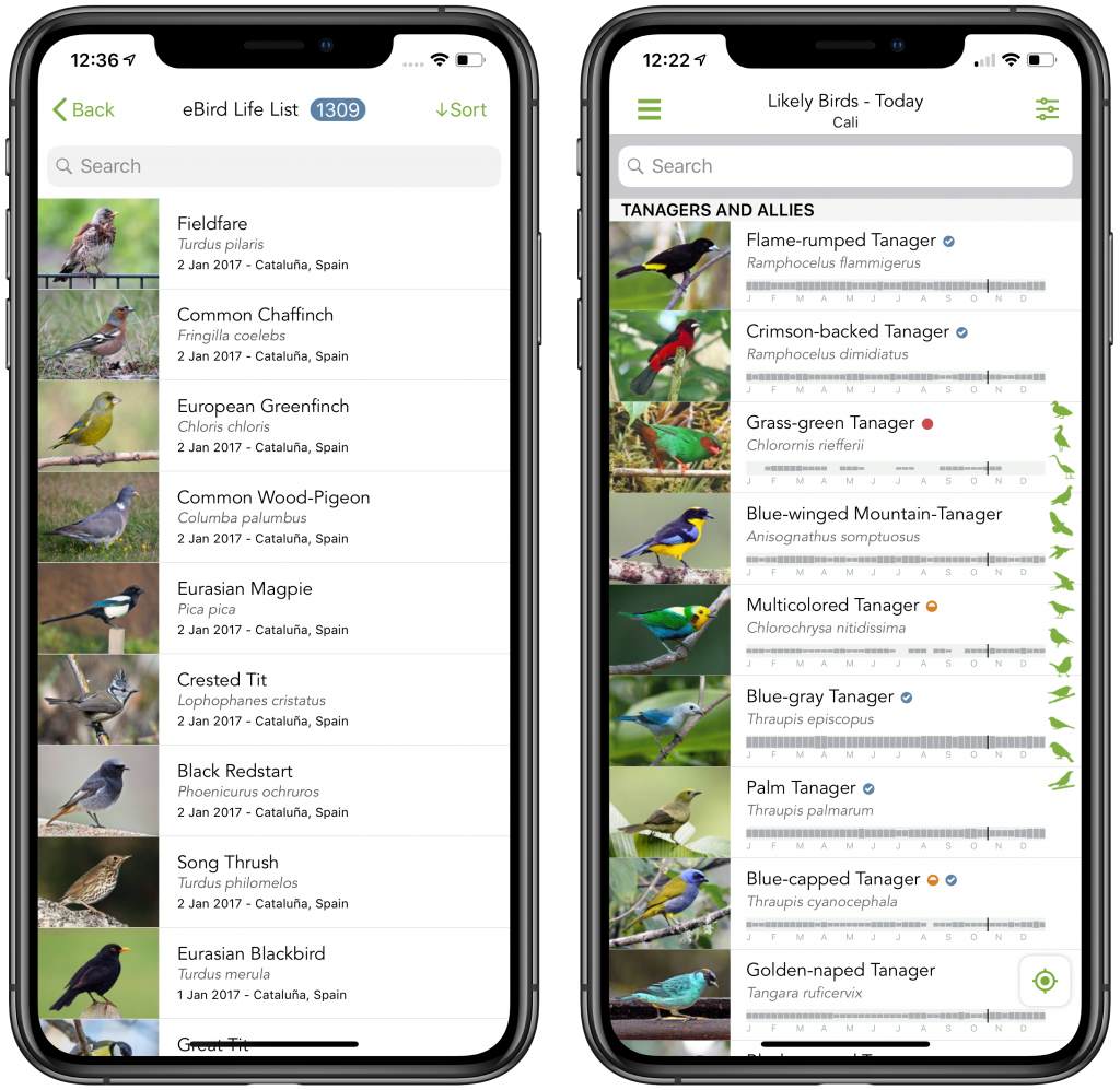
A page from The Cornell Lab of Ornithology’s free Merlin smartphone app.
Another amazing feature in Merlin is its Sound ID: you tap a button in the app, and Merlin “listens” to any bird songs or calls around you and quickly identifies them if you have an active data connection to the Internet. This is a great way to learn bird songs and calls by ear—which is how many advanced birders identify the species around them.
Merlin’s companion app, eBird, is like a virtual checklist where you can record the species you identify, make notes, and even upload photos and audio recordings. This is where the community science happens: when you’re done birding, you can upload your sightings to your free eBird account—and your data is added to the global database. This adds a level of gratification to an already-enjoyable activity, because you’re helping monitor the status of bird species everywhere—many of which are threatened or endangered. You can also view your own personal birding history and life list on the eBird website.
eBird Hotspots along the Pacific Crest Trail
Of the many features in the eBird website, one of the most useful is its index of birding “hotspots,” or areas where a greater number of birders have recorded species. On eBird’s main Hotspot page, you can search for hotspots on a map. Once you find a hotspot in your area, clicking on it takes you to the eBird page for that hotspot, where you can view all the bird species seen there, the dates each species was found, the names of the birders reporting the information, and more. You can even print out a checklist of species for that hotspot if you prefer.
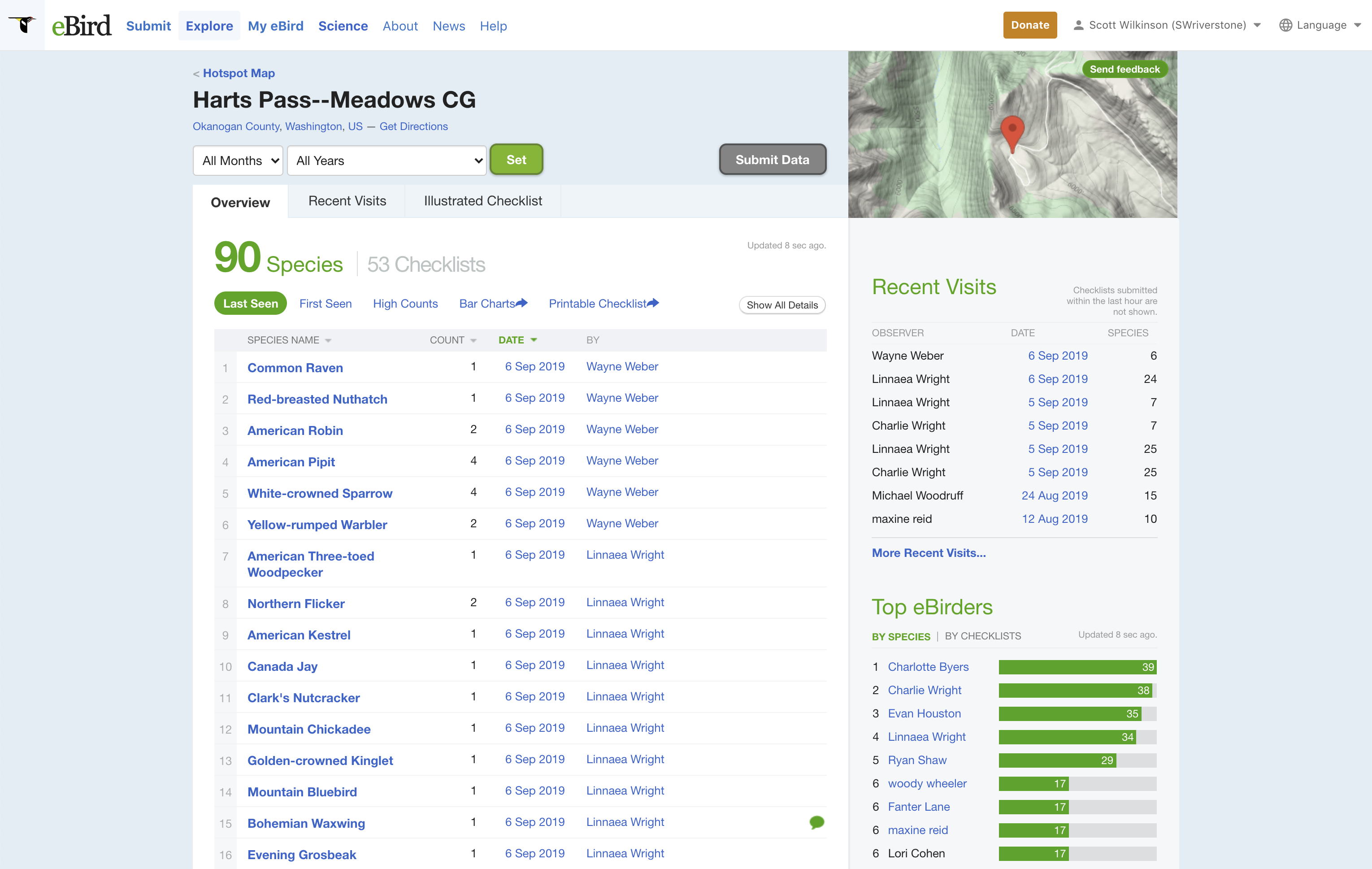
An eBird Hotspot page for Hart’s Pass, Washington.
To help you with birding on the PCT, we’ve put together a list of all eBird hotspots along the Pacific Crest Trail—over 109 hotspots in California, Oregon, and Washington. Each hotspot in the list has a link to the eBird page for that hotspot, where you can view what species have been seen there.
Click here to view and download the Pacific Crest Trail eBird Hotspot List (PDF file).
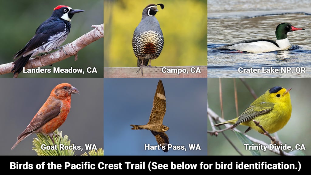
Just for a sample of some of the birds that have been spotted (and you could see) along the PCT, here are some photos from the eBird database…

Campo, California: a California Quail. Photo from eBird and the Macaulay Library, Cornell University.

Landers Meadow, California: an Acorn Woodpecker. Photo from eBird and the Macaulay Library, Cornell University.

Walker Pass, California: a Loggerhead Shrike. Photo from eBird and the Macaulay Library, Cornell University.

Deadfall Lakes in the Trinity Divide, California: a Wilson’s Warbler. Photo from eBird and the Macaulay Library, Cornell University.

Crater Lake National Park, Oregon: a Common Merganser. Photo from eBird and the Macaulay Library, Cornell University.

Goat Rocks Wilderness, Washington: a Red Crossbill. Photo from eBird and the Macaulay Library, Cornell University.

Hart’s Pass, Washington: a Common Nighthawk. Photo from eBird and the Macaulay Library, Cornell University.