Editor’s note March 18, 2026: See this blog post for access updates!
If you are planning to begin your Pacific Crest Trail journey at the Southern Terminus, there is an important access update to understand before you arrive.
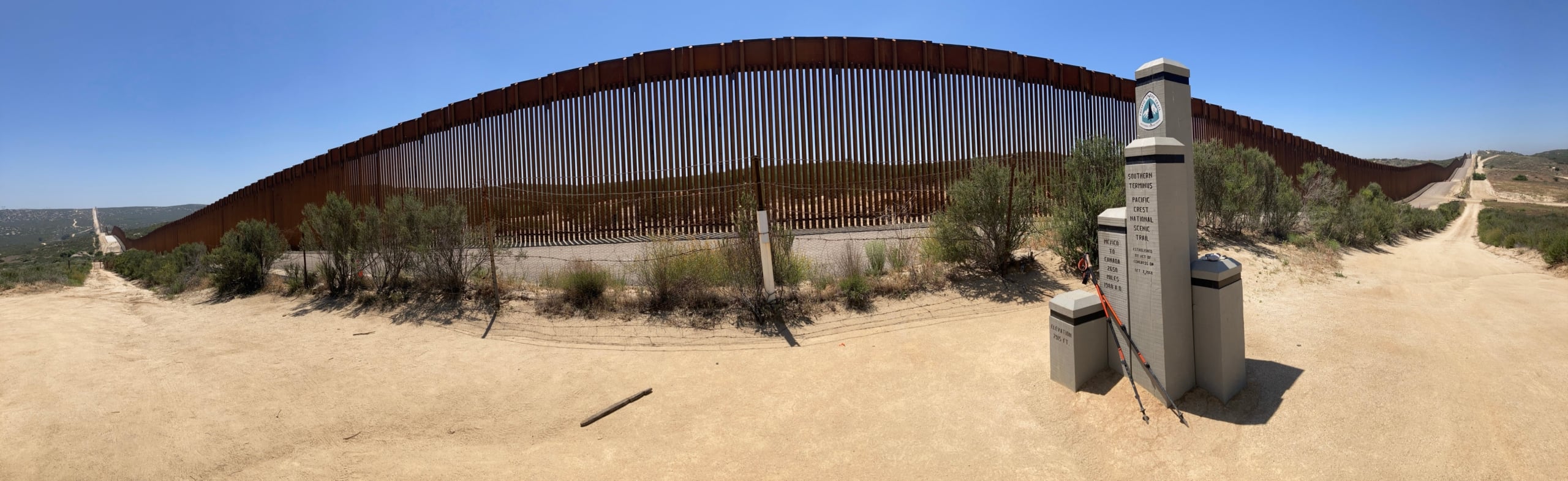
Photo by Jim Dehmlow
The Southern Terminus monument remains accessible, and the Pacific Crest Trail remains open. However, land immediately south of the monument is now within a designated National Defense Area, and public access ends at the barbed wire fence a few feet south of the monument. Touching the border wall is no longer permitted.
According to our federal agency partners, access to land south of the Southern Terminus is no longer allowed as it falls within the National Defense Area. This includes touching the border wall. After visiting the monument, I recommend heading directly north on the trail.
What Changed
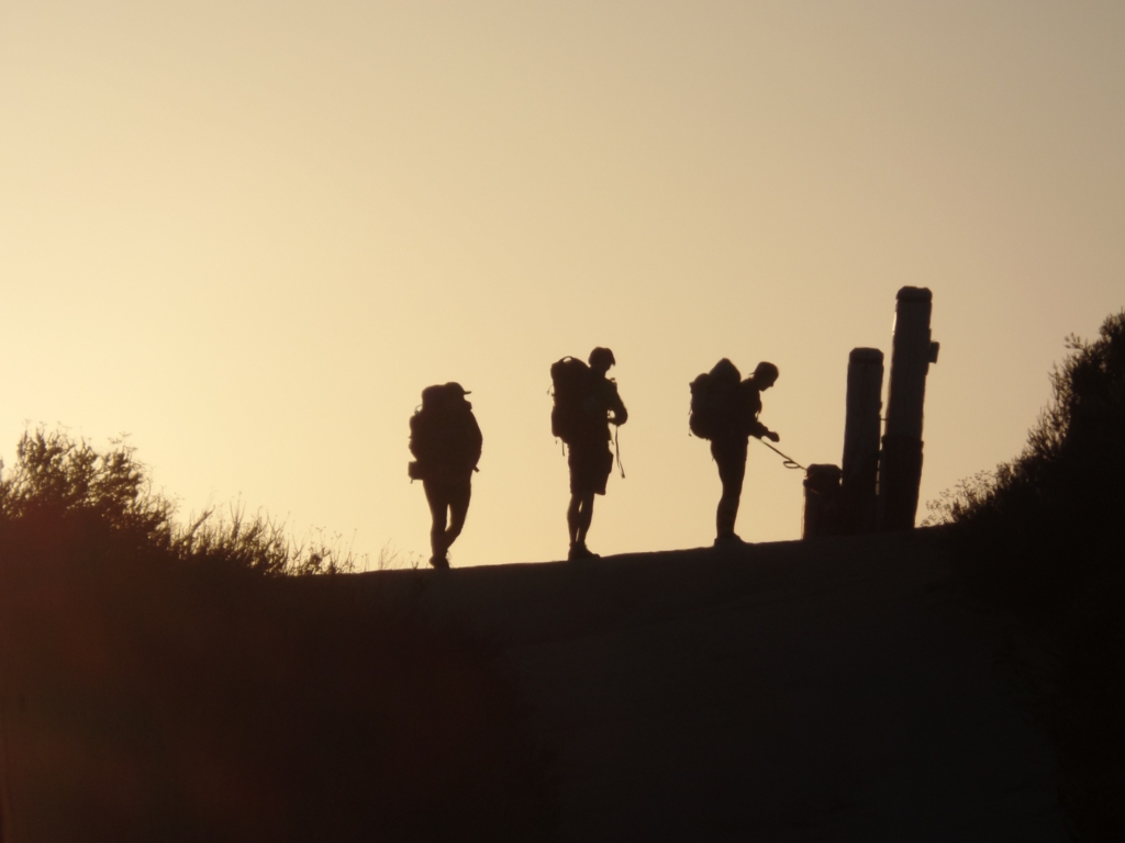
Photo by Keith Selbo
The creation of the National Defense Area was outlined in a National Security Presidential Memorandum issued April 11, 2025. In December 2025, the Department of the Interior, through the Bureau of Land Management, announced the transfer of certain lands, including those known as the Roosevelt Reservation. The Roosevelt Reservation is a 60-foot-wide strip of land that includes the border wall and the road between the wall and the monument. That area is now considered a military installation.
As a result, the land south of the monument is under the control of the Department of Defense (DoD)—referred to in a recent executive order as the “Department of War.” The Southern Terminus monument itself remains accessible to hikers and equestrians.
What This Means for Hikers and Equestrians
- You may visit and take photos at the Southern Terminus monument.
- Public access ends at the barbed wire fence just south of the monument.
- Entry beyond that fence is not permitted.
- Touching the border wall is not allowed.
While the monument remains the official start of the Pacific Crest Trail, we know that for many people, walking to the wall has been a long-standing personal ritual. It is disappointing to lose that tradition. At the same time, it is important that all visitors respect posted boundaries and follow current regulations.
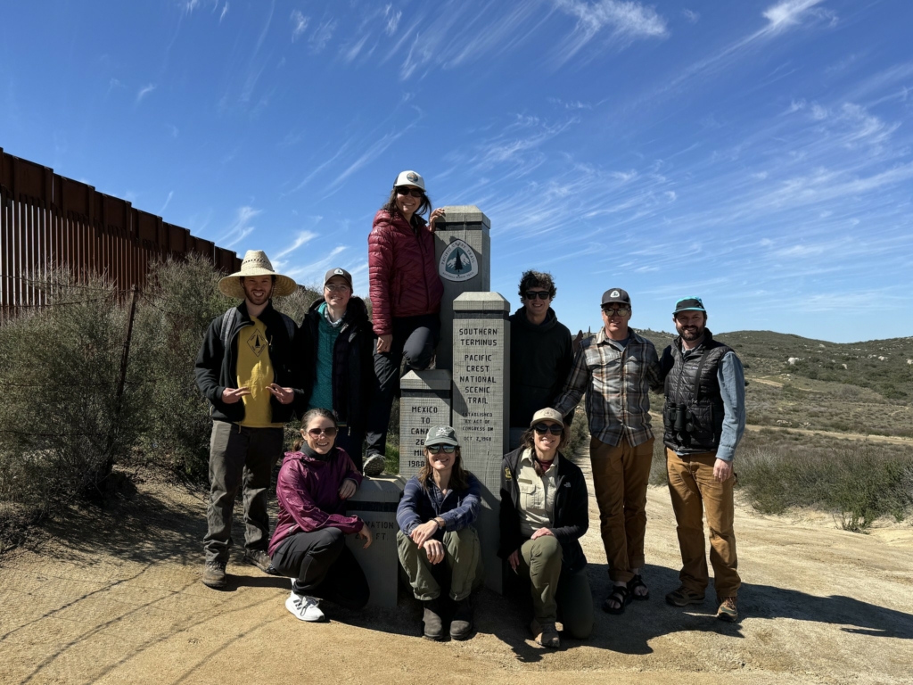
PCTA staff and partners at Southern Terminus. March ’24
Looking Ahead
We are coordinating closely with our partners at the U.S. Forest Service and Bureau of Land Management to stay informed about any additional changes that could affect trail users. For specific questions regarding the National Defense Area, we recommend contacting Joint Task Force Southern Border and/or Naval Air Facility El Centro directly. If the situation changes, we’ll provide that information through our platforms.
We look forward to welcoming you to the start of your journey north.
For additional information, please refer to the following for direct links and official language from the government announcing this transfer.
Official DOI Post about this transfer:
Interior Transfers Public Land to Navy to Support Border Security and National Defense
12/10/2025
Last edited 12/10/2025
Contact Information:
WASHINGTON — The Department of the Interior will transfer jurisdiction of roughly 760 acres of public land in San Diego and Imperial Counties, California, to the Department of the Navy for a three-year period for the Navy to establish a National Defense Area to support ongoing border security operations.
“President Trump has made it clear that securing our border and restoring American sovereignty are top national priorities,” said Secretary of the Interior Doug Burgum. “This action delivers on that commitment. By working with the Navy to close long-standing security gaps, we are strengthening national defense, protecting our public lands from unlawful use, and advancing the President’s agenda to put the safety and security of the American people first.”
The withdrawal area stretches from the western boundary of the Otay Mountain Wilderness Area to about one mile west of the California–Arizona state line. This corridor is one of the highest traffic regions for unlawful crossings along the southern border, creating significant national security challenges and contributing to environmental degradation.
The land, originally reserved in 1907 by President Theodore Roosevelt for border protection purposes, will be used by the Navy to strengthen operational capabilities while reducing ecological harm associated with sustained illegal activity.
The Department of the Interior and the U.S. Navy coordinated closely to ensure the action is both lawful and targeted, reinforcing the historic role public lands have played in safeguarding national sovereignty.