Seeking Trail Information Data Collector volunteers
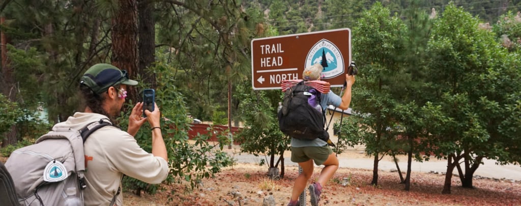
Calling all hikers, outdoor photographers, and data nerds!
Are you visiting the Pacific Crest Trail in 2026? We need your help gathering photos of trailhead parking lots and water sources. Join PCTA as a volunteer Trail Information Data Collector and contribute to building a robust database of information about the ... Read more
Trailwork Project Accomplishment Dashboard
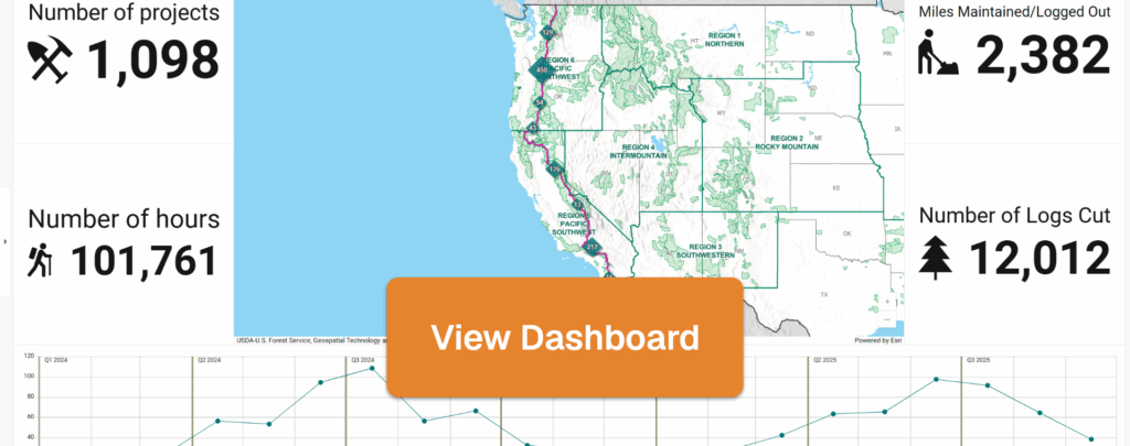
Visualizing accomplishments through the years, and across our 2,650 miles
Each year, PCTA’s volunteers, corps crews, and staff put in tens of thousands of hours toward maintaining the PCT. This devotion of time and energy yields extraordinary results: over 2,000 miles of the PCT have been maintained since ... Read more
Seeking Trail Information Data Collector volunteers

April 14 update: thanks to all of the people who have volunteered to help! We’ve closed recruiting for this project for now.
Calling all hikers, outdoor photographers, and data nerds! Are you visiting the Pacific Crest Trail in 2025? We need your help gathering photos of trailheads. Join PCTA as ... Read more
2025 PCT Centerline and Mile Marker Update
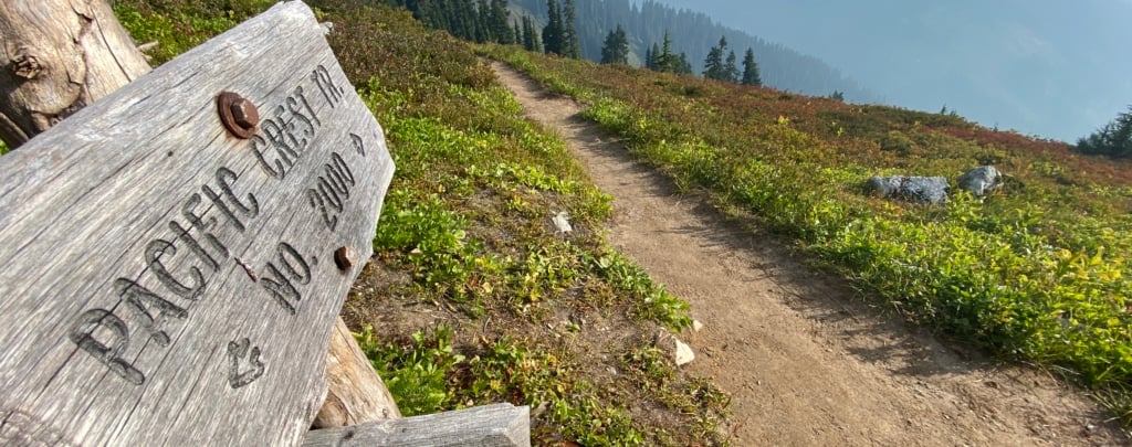
Though we use 2,650 as shorthand for the length of the PCT, it actually shifts a bit year-to-year due to new construction, reroutes, and the like. To dig into this topic, see our previous blog post How long is the PCT really? – Pacific Crest Trail Association. Every January of ... Read more
How long is the PCT really?

Easy, 2,650 Miles, right? Well… not quite. The question of the PCT’s length comes up often, with guidebooks, phone apps, and other sources across the internet offering varying figures. In recent years, PCTA has come a long way in better tracking and calculating distance. While we regularly reference the rounded ... Read more
Exploring the PCT from Home on PCTA’s Updated Interactive Map
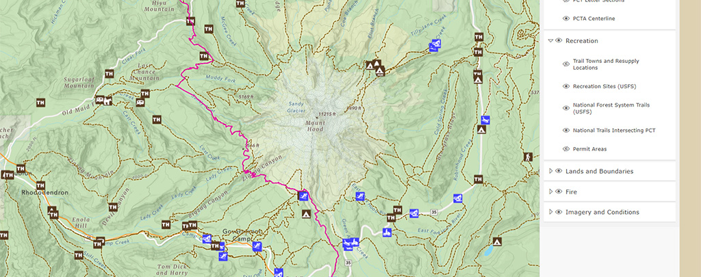
We’re happy to share that we’ve updated our interactive map, making it even more user-friendly and informative. Performance is improved, loading quicker and rendering better on mobile devices. We’ve also added more layers and they are better organized. Remember, the map is always found at the simple address pcta.org/maps.
The ... Read more
Welcome to the blog of the Pacific Crest Trail Association. Check back often for news about the trail.
- Tags
- ACE
- Advocacy
- Art
- Backcountry Technique
- Bears
- Board Of Directors
- Book
- Books
- Botany
- Bridge Of The Gods
- California
- Central CA
- Climate
- Climate Change
- Closure
- Columbia River
- Community Science
- Conservation
- Contest
- Day And Section Hiking
- Day Hike
- Detour
- ECHS
- Ecology
- Employment
- Equestrian
- Ethics
- Event
- Film
- Flora
- Food
- Fundraising
- Gear
- General
- GIS
- Hat Creek Rim
- Health
- High Sierra
- Hike The Hill
- Hiker Culture
- Hiking With Kids
- History
- Horseback Riding
- In Memoriam
- JMT
- John Muir Trail
- Land Protection
- Leave No Trace
- Legislative Funding
- Length
- Life Advice
- Long-distance Hiking
- Love
- Maps
- Membership
- Mental Health
- Miles
- National Trails System
- Natural History
- Navigation
- Northern CA
- Oregon
- Outreach
- Partnership
- Partnerships
- PCT
- PCT Days
- PCTA
- PCTA News
- Permits
- Photography
- Planning
- Press Release
- Profile
- Public Lands
- Radio
- Recreation
- Regulations
- Rescue
- Research
- Resupply
- Risk
- Safety
- Science
- Sierra Nevada
- Snow
- Southbound
- Southern CA
- Southern California
- Staff
- Store
- Technology
- Thru-hiking
- Town Information
- Trail And Land Management
- Trail Angels
- Trail Conditions
- Trail Information
- Trail Maintenance
- Trail Protection
- Trail Skills College
- Trail Stories
- Trail Town
- Trail Towns
- Trail User Information
- Trail Work
- Video
- Visitor Use Management
- Volunteer
- Washington
- Water
- Weather
- WILD
- Wilderness
- Wildfire
- Wildfires
- Wildlife
- Winter
- Women
- Youth